|
The following information has been sourced from the Australian Bureau of Meteorology. The Bureau is a wonderful source of weather information, and also contains a wealth of reference material to assist in the research and learning of this most fascinating science. |
|
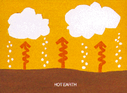
Clouds Of all weather phenomena, clouds are among the most fascinating. From the silky filaments to high altitude cirrus to the towering, threatening mass of storm-bearing cumulonimbus, clouds are as varied as the weather itself. Apart from their beauty and interest, clouds can provide a useful indication of weather conditions, and weather observers at some 500 locations around Australia send regular reports to Bureau of Meteorology Forecasting Offices on cloud types, height, and the amount of sky covered. Cloud formation Clouds have their origins in the water that covers 70 per cent of the earth's surface. Millions of tons of water vapour are evaporated into the air daily from oceans, lakes and rivers, and by transpiration from trees, crops and other plant life. As this moist air rises it encounters lower pressures, expands as a result, and in doing so becomes cooler. As the air cools it can hold less water vapour and eventually will become saturated. It is from this point that some of the water vapour will condense into tiny water droplets to form cloud (about one million cloud droplets are contained in one rain-drop). Thus, whenever clouds appear they provide visual evidence of the presence of water in the atmosphere. |
|
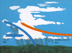
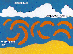
There are four ways in which moist air can be lifted to form cloud. They are: |
Orographic lifting occurs when air is forced upward by a barrier of mountains or hills. |
Convective lifting occurs when air heated at the earth's surface rises in the form of thermal currents or bubbles. |
Widespread ascent results from the interaction of air masses, or the movement of a cold air mass forcing warm air to rise ahead of it. |
Mechanical (or frictional) turbulence occurs when the air flow is deformed into a series of eddies as it moves over the earth's surface. |
|
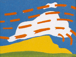
Cloud classification There are ten main cloud types, which are further divided into 27 sub-types according to their height shape, colour and associated weather, Clouds are categorised as low (from the earth's surface to 2.5 km), middle (2.5 to 6 km), or high (above 6 km). They are given Latin names which describe their characteristics, e.g. cirrus (a hair), cumulus (a heap), stratus (a layer) and nimbus (rain-bearing). It's an interesting fact that all clouds are white, but when viewed from the ground some appear grey or dark grey according to their depth and shading from higher cloud. Typical examples of the ten main cloud types are shown |
|
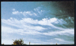
Cirrus: high level, white tufts or filaments; made up of ice crystals. (No precipitation.) |
Cirrocumulus: high level, small rippled elements; ice crystals. (No precipitation.) |
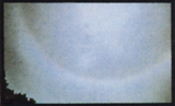
Cirrostratus: high level, transparent sheet or veil, halo phenomena; ice crystals. (No precipitation.) |
|
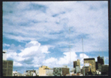
Altocumulus: middle level layered cloud, rippled elements, generally white with some shading. May produce light showers. |
Altostratus: middle level grey sheet, thinner layer allows sun to appear as through ground glass. Precipitation: rain or snow. |
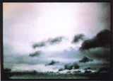
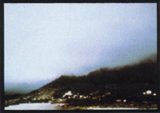
Nimbostratus: thicker, darker and lower based sheet. Precipitation: heavier intensity rain or snow. |
|
Stratocumulus: low level layered cloud, series of rounded rolls, generally white. Precipitation: drizzle. |
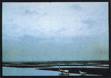
Stratus: low level layer or mass, grey, uniform base; if ragged, referred to as "fractostratus". Precipitation: drizzle. |
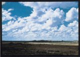
Cumulus: low level, individual cells, vertical rolls or towers, flat base. Precipitation: showers of rain or snow. |
|
Cumulonimbus: low level, very large cauliflower-shaped towers to 16 km high, often "anvil tops". Phenomena: thunderstorms, lightning, squalls. Precipitation: showers of rain or snow. |
© Copyright Commonwealth of Australia 2007, Bureau of Meteorology (ABN 92 637 533 532)